Saturday, September 19, 2009

Scottish Games in Charleston 9/19

http://charlestonscots.org/

We are meeting at the Orangeburg Cracker Barrel at 8:00 on Saturday! That's at exit 145A on I-26.

Take EXIT 145A US-601 S RAMP 0.45 miles

Stay STRAIGHT to go onto SAINT MATTHEWS RD/ST MATTHEWS RD/US-601 (Going Southwest) 0.20 miles

Turn LEFT onto CITADEL RD (Going East) 0.08 miles

Turn RIGHT onto REGIONAL PKY (Going East) 0.48 miles

Turn RIGHT onto CITADEL RD (Going Southeast) 1.26 miles

The Games are at Boone Hall Plantation :

Directions :

From I-26: Take I-526 East towards Mt. Pleasant. Take the Long Point Road exit.
At bottom of exit turn Left. The entrace to Boone Hall will be 2 miles up on the
left.


Address :

1235 Long Point RoadMt. Pleasant, SC 29464

Location :

http://maps.google.com/maps?f=q&source=s_q&hl=en&geocode=&q=1235+Long+Point+Road,+Mt.+Pleasant,+SC+29464&sll=33.773665,-81.019795&sspn=0.832171,0.961304&ie=UTF8&z=17&iwloc=A

Friday, September 4, 2009

side trip : North Fork Edisto

This isn't an official Trailblazer trip, just a (growing!) number of folks going paddling.

Orangeburg is about an hour away from the Columbia area. The shuttle is about 20 minutes, the river about 10 miles or about 3 hours.

Trail description : http://www.sctrails.net/Trails/ALLTRAILS/WaterTrails/EdistoNoFork.html

Takeout, meeting place : http://maps.google.com/maps?q=33.48582+-80.87075
Put in : http://maps.google.com/maps?q=33.525487,-80.947402
My "google map" : http://maps.google.com/maps/ms?ie=UTF&msa=0&msid=113743287332160291459.000472becb5544b5dc88a

Gauge : http://waterdata.usgs.gov/nwis/uv?cb_00060=on&cb_00065=on&format=gif_default&period=7&site_no=02173500

Info about the gardens : http://www.orangeburg.sc.us/gardens/

Sunday, August 16, 2009

Dreher Outing Sunday August 16

We have a family outing scheduled for this Sunday afternoon that we hope you can attend. We considered Saluda Shoals, but the shelters are booked. Dreher Island has 15 shelters available (1st come 1st serve) at no charge.

This is a family event and we are planning to grill hotdogs and have a "pot-luck" meal. So please plan to bring a dish or 2 to share
Time: Sunday August 16th from 2:00 to 6:30PM +/-
Place: Dreher Island State Recreation Area
3677 State Park RD
Prosperity,SC 29127
Phone: (803) 364-4152
Driving Directions:
From I-26: Take exit 91 (Chapin exit- Hwy. 48) to Chapin. Turn rt on Hwy 76 for 1/8 mile, then turn left onto St. Peter's Church Rd (Hwy. 29) for 4 mi. Turn left onto Dreher Island Rd (Hwy 231) for approximately 3 mi. Then turn onto State Park Rd for 2 mi. to the park entrance.
  • Admissions: $2 adults; $1.25 SC seniors; age 15 & younger free
  • Days and Hours of Operation: M-Su Dawn to Dusk

Friday, July 31, 2009

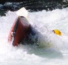
Whitewater Rafting on the Nantahala

Per Chris :
This is scheduled for July 31-August2. We will camp on the 31st and the 1st and raft on the 1st. Camping at Ela camp ground, prices is $5/person/tent/night. Cabins are available at $8/person/night. 5 person requirement for cabin. Have not discussed down payment with camp ground people yet. Rafting sat. 10am which should put us back in time for lunch. Cost $22/person for guide assisted. We will be rafting with the paddle inn rafting co. payment due when we get there as a whole.

We need a head count for the august outing ASAP - please contact Chris Himes.

The campground :

The rafting company :
Directions :

Menu
Fri - Dinner - on your own
Sat - Breakfast - French Toast and Little Smokies
Sat- Lunch - Sandwiches (*)
Sat - Dinner - Chicken (BYO), salads, sides, cobblers
Sun - Breakfast - Breakfast Burritos and Grits

(*) I would strongly encourage you to bring a snack for after rafting - lunch will likely be a bit late - Scott

Monday, June 22, 2009

Saluda Whitewater Canoeing

This outing is planned to be a canoe trip on the Saluda that will include some instruction and a chance to run some whitewater. Tentatively we are planning to go from Riverbanks Zoo down to the Gervais Street bridge. This stretch includes several class I and II rapids.

These are the topics we will cover before going down the river :
  • Boat control - some tips on what to do to make the boat go where you want it to
  • "Reading the water" - some tips on how to know where to go when running a rapid
  • Rescue - what to do when your boat tips over -
  • how to swim in moving water
  • how to use a throw rope
  • how to perform a "boat over boat" rescue
We'll be practicing these in the water so be ready to get wet!

Schedule :
  • 09:00 hrs we will meet at the Riverbanks Zoo Parking lot (Right side of the parking lot facing the zoo entrance)
  • 09:30 hrs be in the water and start instruction
  • 10:30 - 11:00 hrs head down river
  • 12:00 - lunch
  • 14:00-15:00 get out of the river!
Between the Broam "fleet" and the YMCA's canoes, we can provide 6-8 canoes and equipment. We know that a number of you have canoes, too. We ought to be able to come up with boats for all, but if not, we can rent additional canoes and share the cost (which should be minimal).

NOTE : While this trip will be suitable for even our smallest and youngest Trailblazers, note that having more than one child in your canoe will be more challenging (but not impossible). If you would like to bring more than one youngster with you, consider recruiting an adventurous uncle, grandpa, or mom to come along. Please contact Scott if you have any questions or concerns.

Watch this space for a checklist of things to bring!

Friday, June 19, 2009

Virginia Creeper Trail Trip

Some handy links

A map of various points of interest and a route from Lexington to the campground :
http://maps.google.com/maps/ms?ie=UTF&msa=0&msid=113743287332160291459.00046befe6f2e31c1fa6e

The campground - Grindstone Campground near Troutdale, VA :
http://www.recreation.gov/camping/Grindstone_Va/r/campgroundDetails.do?page=details&contractCode=NRSO&parkId=70449&topTabIndex=CampingSpot

The bike outfitter : http://www.jcsoutdoors.com/
Trail information :
http://www.vacreepertrail.org/
http://www.vacreepertrail.com/trailMaps/trailMaps.htm

Sunday, May 31, 2009